
Here’s the low-down…
- The National Parks Highway (aka Route 89) includes stops at seven major US national parks
- US Route 89 was created in the 1930s before being completed in the late 1940s with the addition of US Route 87
- It runs from the Canadian border in Montana to Flagstaff, AZ (or Nogales, if you want to drive to the Mexican border)
Videos by TravelAwaits
When you think of the most famous and scenic American road trips, which come to mind?
It’s hard to beat the legacy and mythology of Route 66—even if it’s seen better days. A close second is California’s famous Pacific Coast Highway. Maybe even Colorado’s Million Dollar Highway, which cuts through the Rockies.
But there’s another worthy American road trip out there.
One that will take you from Flagstaff, Arizona, to some of the US’s most popular, stunning national parks—all the way up through Montana to the border of Canada.
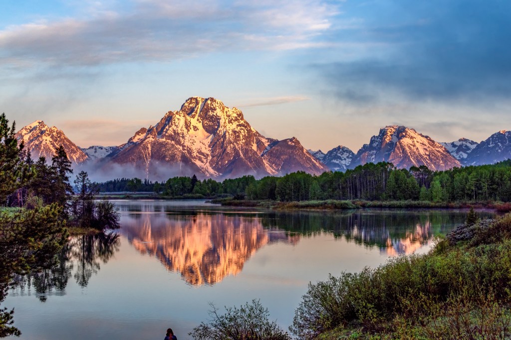
It’s called Route 89, aka The National Parks Highway. Back in 2019, Nat Geo named it the No. 1 Driver’s Drive in the world, but the word still hasn’t gotten out to all road-trippers, nature-lovers, and horizon-hunting hikers.
Ready to learn how to string together a road trip to the US’s most stunning protected lands? Here’s how the average traveler can drive US Route 89 to see some of the country’s most jaw-dropping sights.
Route 89, aka National Parks Highway
First up—don’t get the National Park to Park Highway. The National Park to Park Highway is a historic auto trail project from the 1920s that created a loop.
Similar to Route 89, this loop brought intrepid drivers to some of the best national parks in the Rockies and just west of them. It covered 5,000 miles and took around 80 days to complete.
During the 1930s, the southern portions of US Route 89 began to take shape. Portions of US Route 87 were added in 1945, when the route officially linked Arizona to Havre, Montana. The official southern point of the route wasn’t established until 1992, when the highway was connected to Flagstaff, Arizona.
Today, US Route 89 runs along a single north-south highway that connects Arizona, Utah, Wyoming, and Montana. It includes stops in major towns and cities like Flagstaff, Provo, Salt Lake City, Jackson, and Great Falls. (Technically, the National Parks Highway passes through Idaho, but only for a few miles.)
The modern route starts in Flagstaff, then heads up to the southern entrance of Yellowstone National Park. (Historically, it started further south in Nogales, on the border with Mexico. If you want, you can still start from Nogales, which gives you access to Saguaro National Park!)
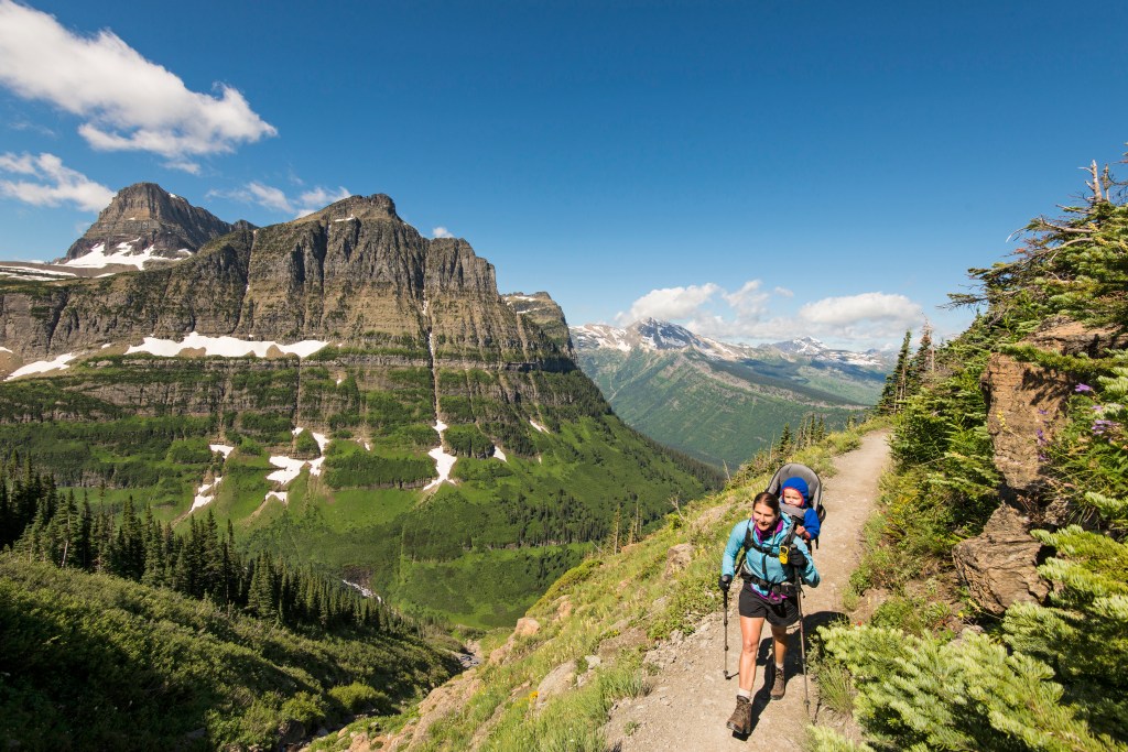
The section that cuts through Yellowstone National Park isn’t technically part of US Route 89 because the roads are unnumbered, but you can rejoin from the park’s northern entrance. The route ends at the Canadian border in Montana near the town of Babb.
National parks & monuments along Route 89
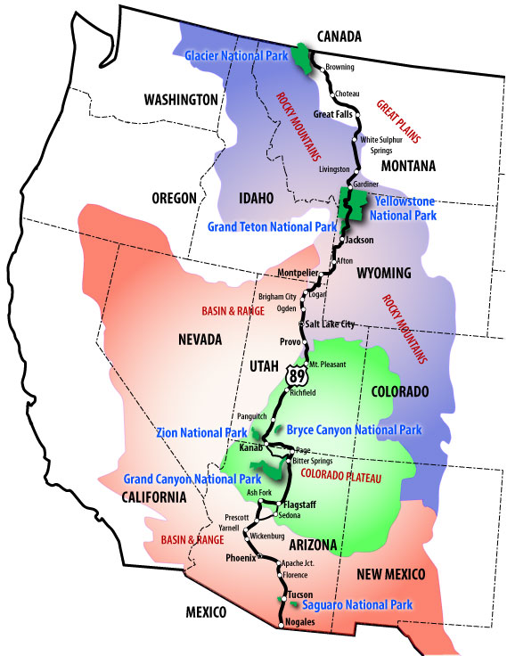
US Route 89 gives you access to seven national parks and 14 national monuments, plus a few other great stops. I’ve listed them below (plus, a few extra stops), starting from Flagstaff and moving north to Montana. They’re broken down state by state.
(Please note that you can add more adventures to this list! I’m focused on national parks and national monuments, but you can piece together other landmarks using the links below.)
Arizona stops on the National Parks Highway
- Grand Canyon National Park (North and South rims)
- Petrified Forest National Park
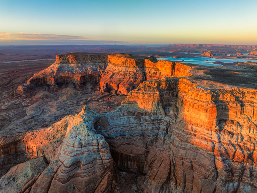
- Glen Canyon National Recreation Area (Antelope Canyon & Horseshoe Bend)
- Pipe Spring National Monument
Utah stops on the National Parks Highway
- Zion National Park
- Bryce Canyon National Park
- Capitol Reef National Park
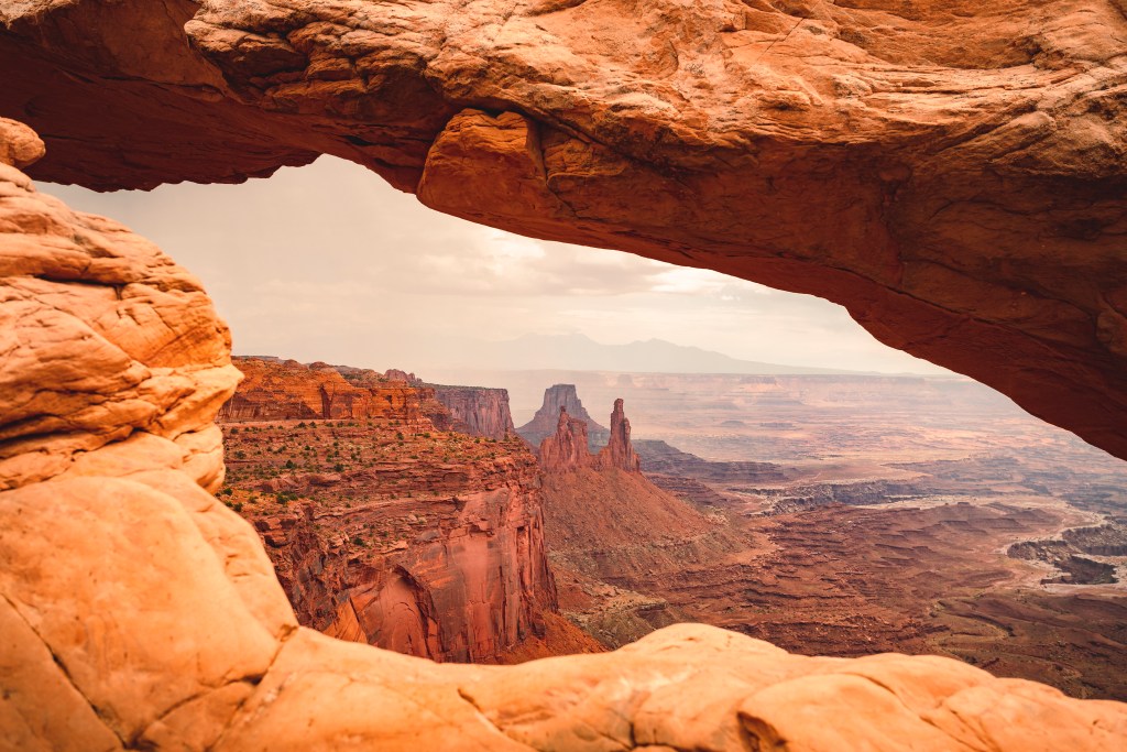
- Canyonlands National Park
- Arches National Park
Wyoming stops on the National Parks Highway
Montana stops on the National Parks Highway